Every home Aktera lists sits inside a city that has been continuously lived in since antiquity. Here's what's actually around you — not a tourist checklist, but the landmarks that make each neighborhood what it is.
00 / 18
The map
Ancient ruins, Byzantine monasteries, and the museums holding what was found in between — filter by kind, or click a pin.
Scroll to walk the map, or choose a point.
The gold atlas works on its own. The street map underneath is optional.
Map hidden. Loading it connects to Mapbox (USA), which receives your IP address and stores an identifier in your browser.
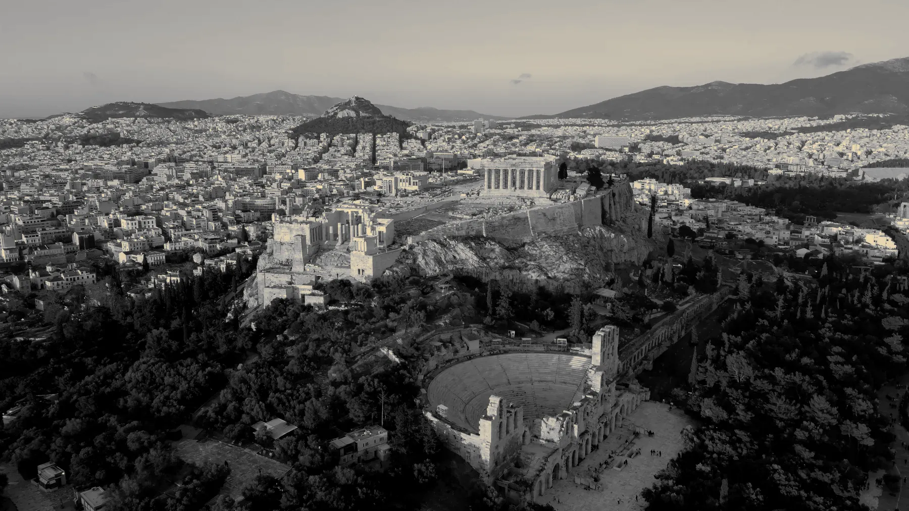
The AcropolisSeen from above, with the Odeon of Herodes Atticus at its foot.
The Parthenon and the sacred rock that has watched over the city for 2,500 years — still the first thing every resident points to when explaining where they live.
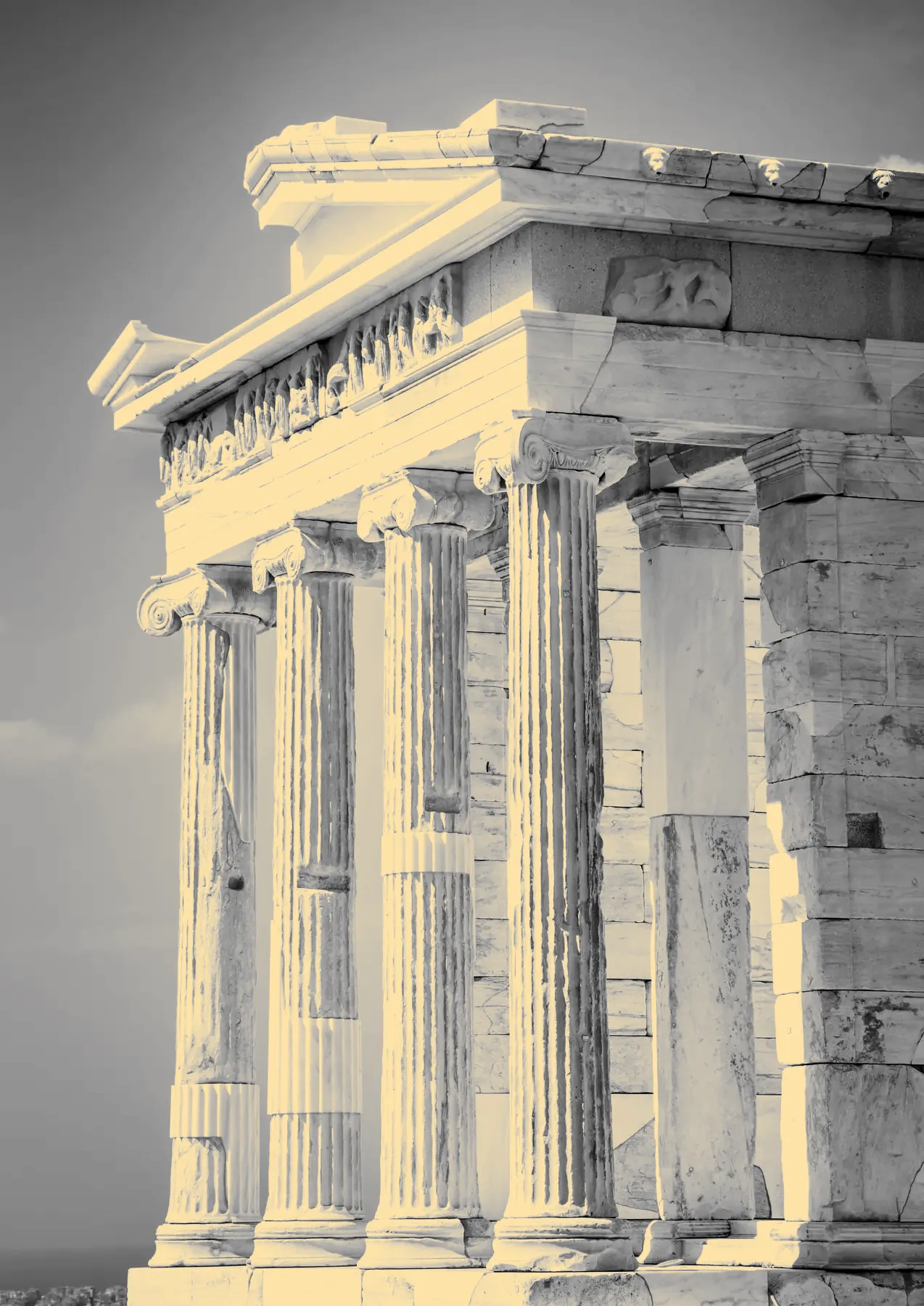
The small Ionic temple at the entrance to the Acropolis.
37.9715° N · 23.7261° E
03 / 18
The Acropolis
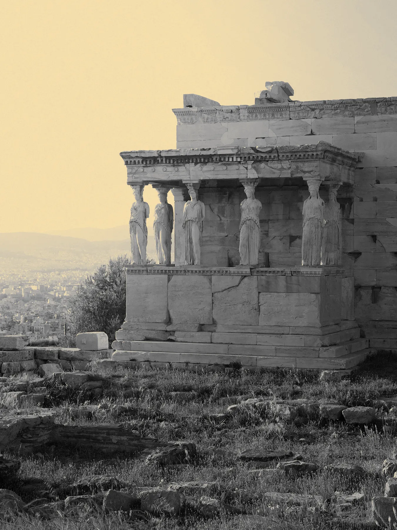
The Erechtheion
Home of the Caryatids, on the north side of the rock.
37.9715° N · 23.7261° E
04 / 18
Museums · Opened 2009
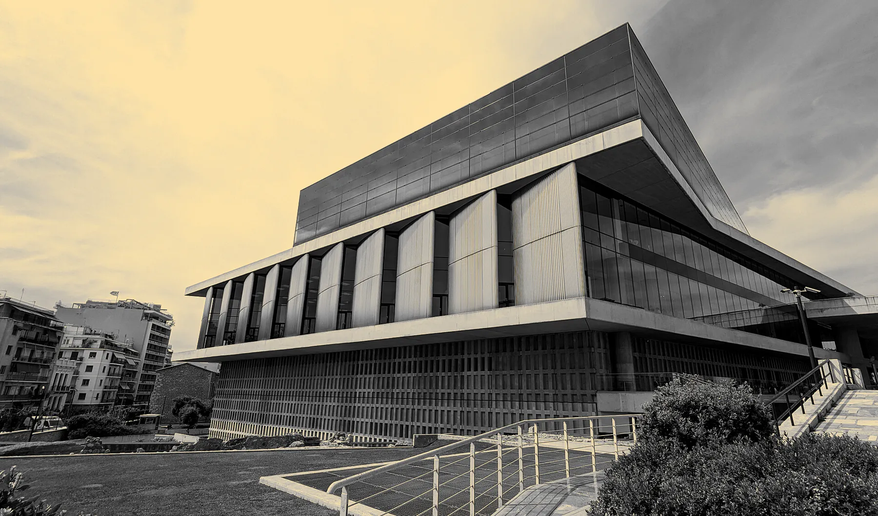
Acropolis Museum
“New Acropolis Museum building in Athens, Greece” by philip.mallis, via Wikimedia Commons, licensed under CC BY-SA 2.0. Cropped and colour-graded by Aktera; this adapted image is licensed under CC BY-SA 2.0.«New Acropolis Museum building in Athens, Greece» από philip.mallis, μέσω Wikimedia Commons, με άδεια CC BY-SA 2.0. Περικοπή και χρωματική επεξεργασία από την Aktera· η προσαρμοσμένη εικόνα διατίθεται με άδεια CC BY-SA 2.0.“New Acropolis Museum building in Athens, Greece” מאת philip.mallis, דרך Wikimedia Commons, ברישיון CC BY-SA 2.0. נחתך ועבר עיבוד צבע על ידי Aktera; התמונה המעובדת מוצעת ברישיון CC BY-SA 2.0.
A glass-floored, light-filled museum built directly over an excavated ancient neighborhood, holding everything found on the rock above it.
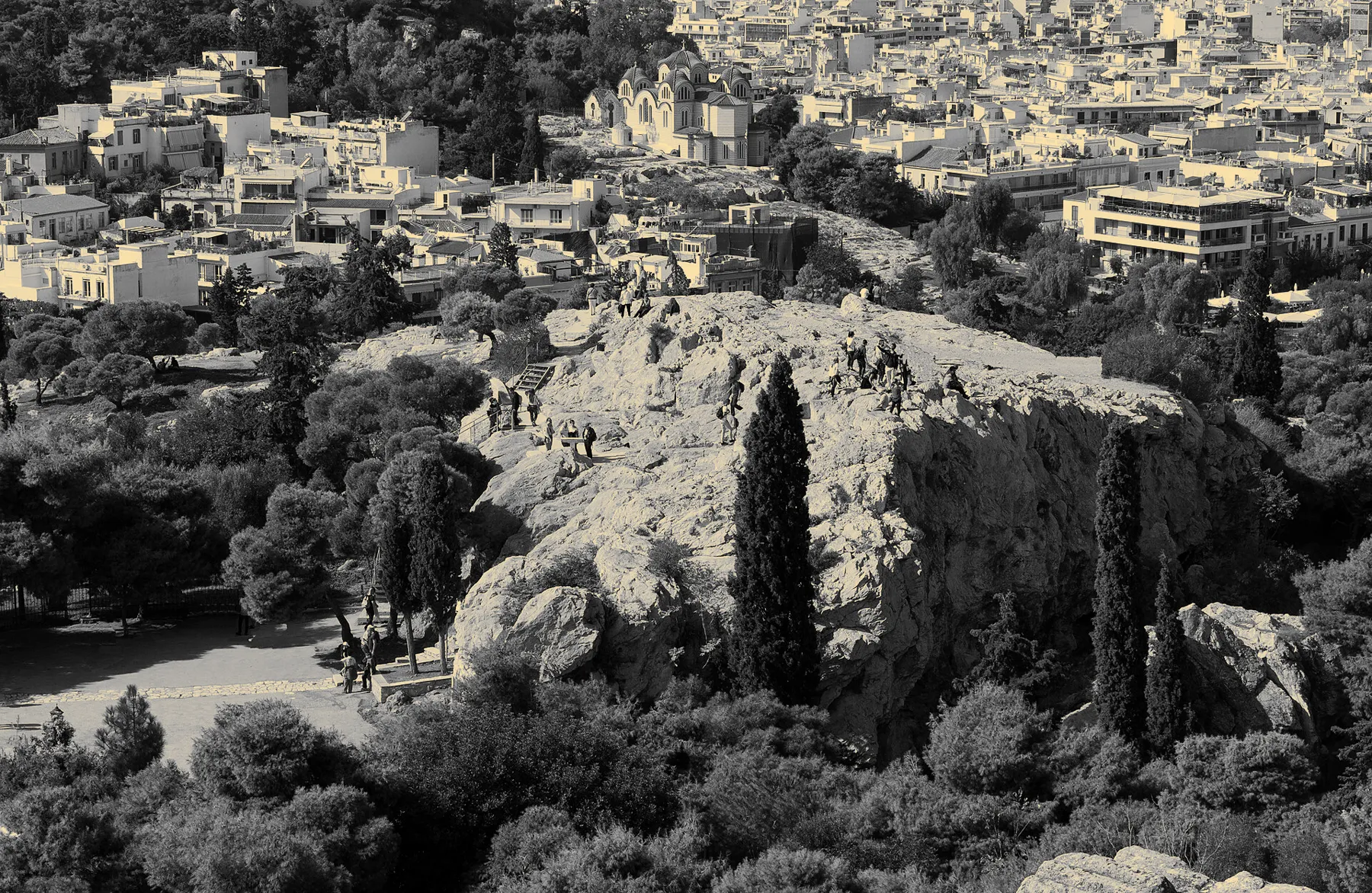
“Areopagus hill Saint Paul from Acropolis Athens” by Jebulon, via Wikimedia Commons, licensed under CC0. Cropped and colour-graded by Aktera; this adapted image is licensed under CC0.«Areopagus hill Saint Paul from Acropolis Athens» από Jebulon, μέσω Wikimedia Commons, με άδεια CC0. Περικοπή και χρωματική επεξεργασία από την Aktera· η προσαρμοσμένη εικόνα διατίθεται με άδεια CC0.“Areopagus hill Saint Paul from Acropolis Athens” מאת Jebulon, דרך Wikimedia Commons, ברישיון CC0. נחתך ועבר עיבוד צבע על ידי Aktera; התמונה המעובדת מוצעת ברישיון CC0.
The bare rock where Athens' highest court once sat, and where Saint Paul preached to the Athenians — a five-minute scramble for one of the best sunset views in the city.
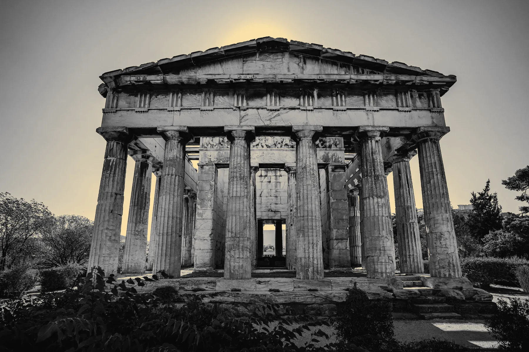
Temple of HephaestusThe best-preserved temple in Greece, above the Ancient Agora.
Athens' original public square and marketplace — where democracy was argued into existence, now a shaded archaeological park below the Acropolis.
37.9750° N · 23.7225° E
07 / 18
Ancient & Classical · 3rd millennium BC – Roman era
Kerameikos
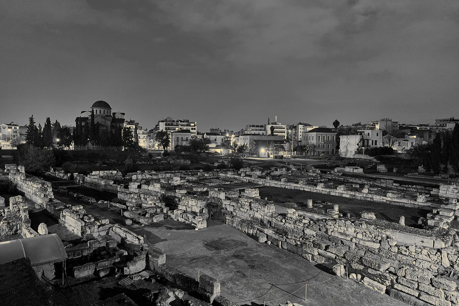
“The archaeological site of Kerameikos on November 17, 2019” by George E. Koronaios, via Wikimedia Commons, licensed under CC BY-SA 4.0. Cropped and colour-graded by Aktera; this adapted image is licensed under CC BY-SA 4.0.«The archaeological site of Kerameikos on November 17, 2019» από George E. Koronaios, μέσω Wikimedia Commons, με άδεια CC BY-SA 4.0. Περικοπή και χρωματική επεξεργασία από την Aktera· η προσαρμοσμένη εικόνα διατίθεται με άδεια CC BY-SA 4.0.“The archaeological site of Kerameikos on November 17, 2019” מאת George E. Koronaios, דרך Wikimedia Commons, ברישיון CC BY-SA 4.0. נחתך ועבר עיבוד צבע על ידי Aktera; התמונה המעובדת מוצעת ברישיון CC BY-SA 4.0.
The city's ancient cemetery and potters' quarter — the quietest, greenest archaeological site in central Athens, and the source of its name (keramos, pottery clay).
37.9783° N · 23.7189° E
08 / 18
Ancient & Classical · 5th century BC
The Pnyx
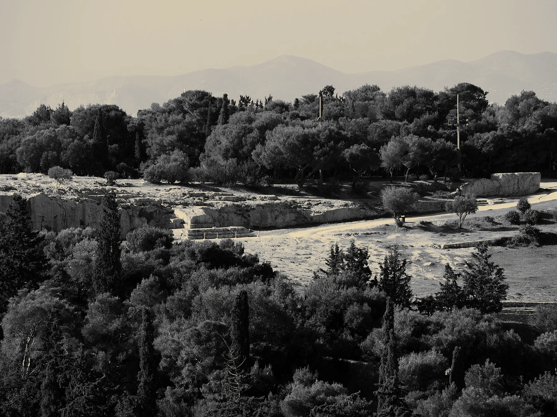
“Πνύκα 6213” by C messier, via Wikimedia Commons, licensed under CC BY-SA 4.0. Cropped and colour-graded by Aktera; this adapted image is licensed under CC BY-SA 4.0.«Πνύκα 6213» από C messier, μέσω Wikimedia Commons, με άδεια CC BY-SA 4.0. Περικοπή και χρωματική επεξεργασία από την Aktera· η προσαρμοσμένη εικόνα διατίθεται με άδεια CC BY-SA 4.0.“Πνύκα 6213” מאת C messier, דרך Wikimedia Commons, ברישיון CC BY-SA 4.0. נחתך ועבר עיבוד צבע על ידי Aktera; התמונה המעובדת מוצעת ברישיון CC BY-SA 4.0.
The hillside where the Athenian Assembly met to invent direct democracy — ordinary citizens, standing on this same slope, voting on the laws that governed them.
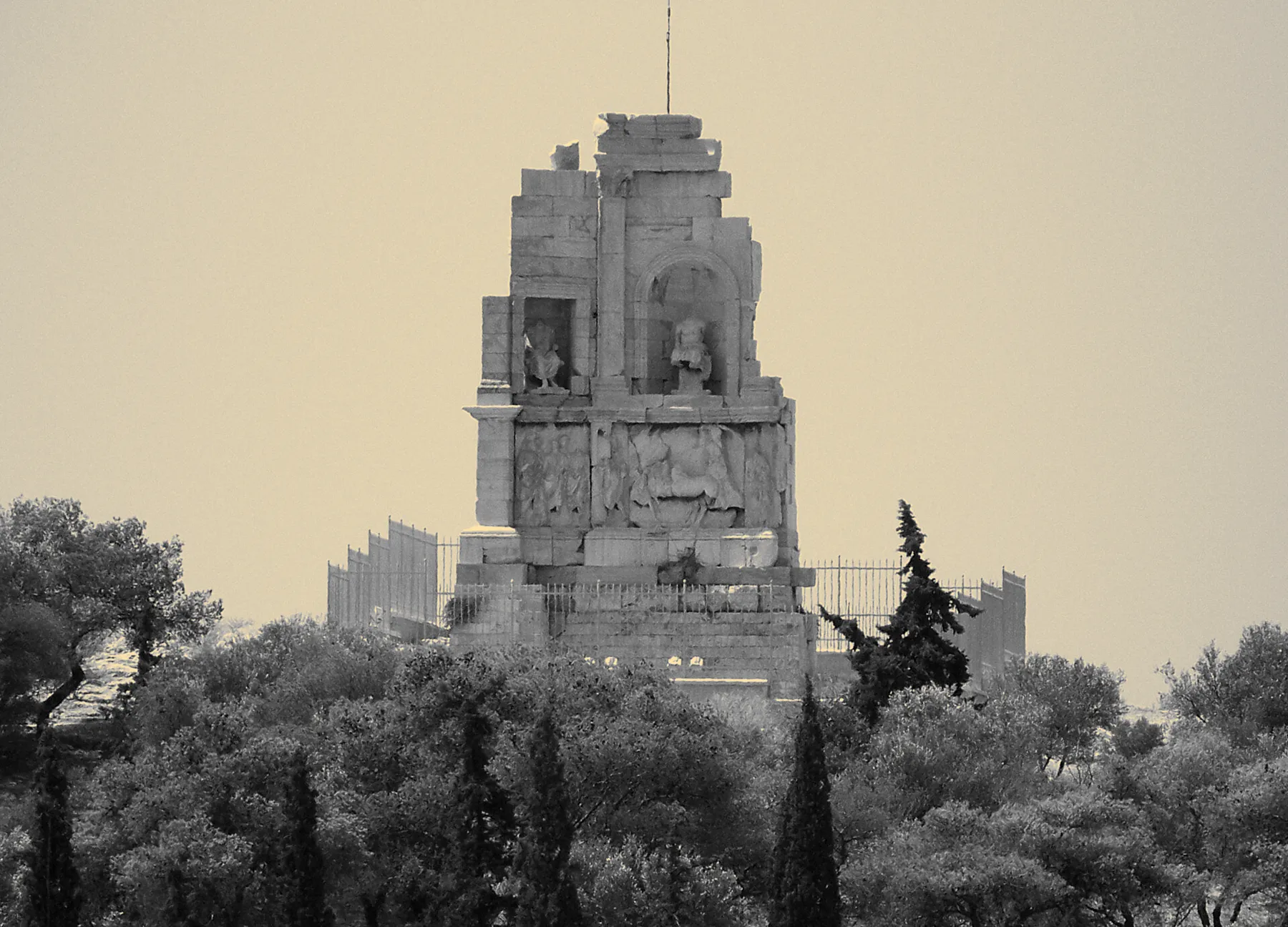
“Monument de Philopappos crop” by Eusebius, via Wikimedia Commons, licensed under CC BY 3.0. Cropped and colour-graded by Aktera; this adapted image is licensed under CC BY 3.0.«Monument de Philopappos crop» από Eusebius, μέσω Wikimedia Commons, με άδεια CC BY 3.0. Περικοπή και χρωματική επεξεργασία από την Aktera· η προσαρμοσμένη εικόνα διατίθεται με άδεια CC BY 3.0.“Monument de Philopappos crop” מאת Eusebius, דרך Wikimedia Commons, ברישיון CC BY 3.0. נחתך ועבר עיבוד צבע על ידי Aktera; התמונה המעובדת מוצעת ברישיון CC BY 3.0.
A pine-covered hill crowned by the Monument of Philopappos, facing the Acropolis directly — locals' favorite quiet walk with the best photograph in Athens.
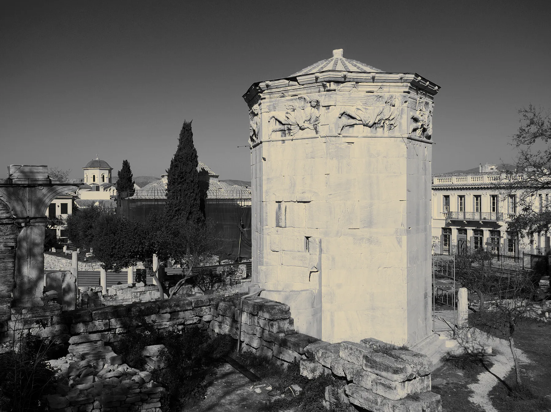
“Πύργος των Ανέμων 6173” by C messier, via Wikimedia Commons, licensed under CC BY-SA 4.0. Cropped and colour-graded by Aktera; this adapted image is licensed under CC BY-SA 4.0.«Πύργος των Ανέμων 6173» από C messier, μέσω Wikimedia Commons, με άδεια CC BY-SA 4.0. Περικοπή και χρωματική επεξεργασία από την Aktera· η προσαρμοσμένη εικόνα διατίθεται με άδεια CC BY-SA 4.0.“Πύργος των Ανέμων 6173” מאת C messier, דרך Wikimedia Commons, ברישיון CC BY-SA 4.0. נחתך ועבר עיבוד צבע על ידי Aktera; התמונה המעובדת מוצעת ברישיון CC BY-SA 4.0.
Rome's marketplace addition to the city, anchored by the world's oldest surviving meteorological station — now the doorstep of Plaka's cafés.
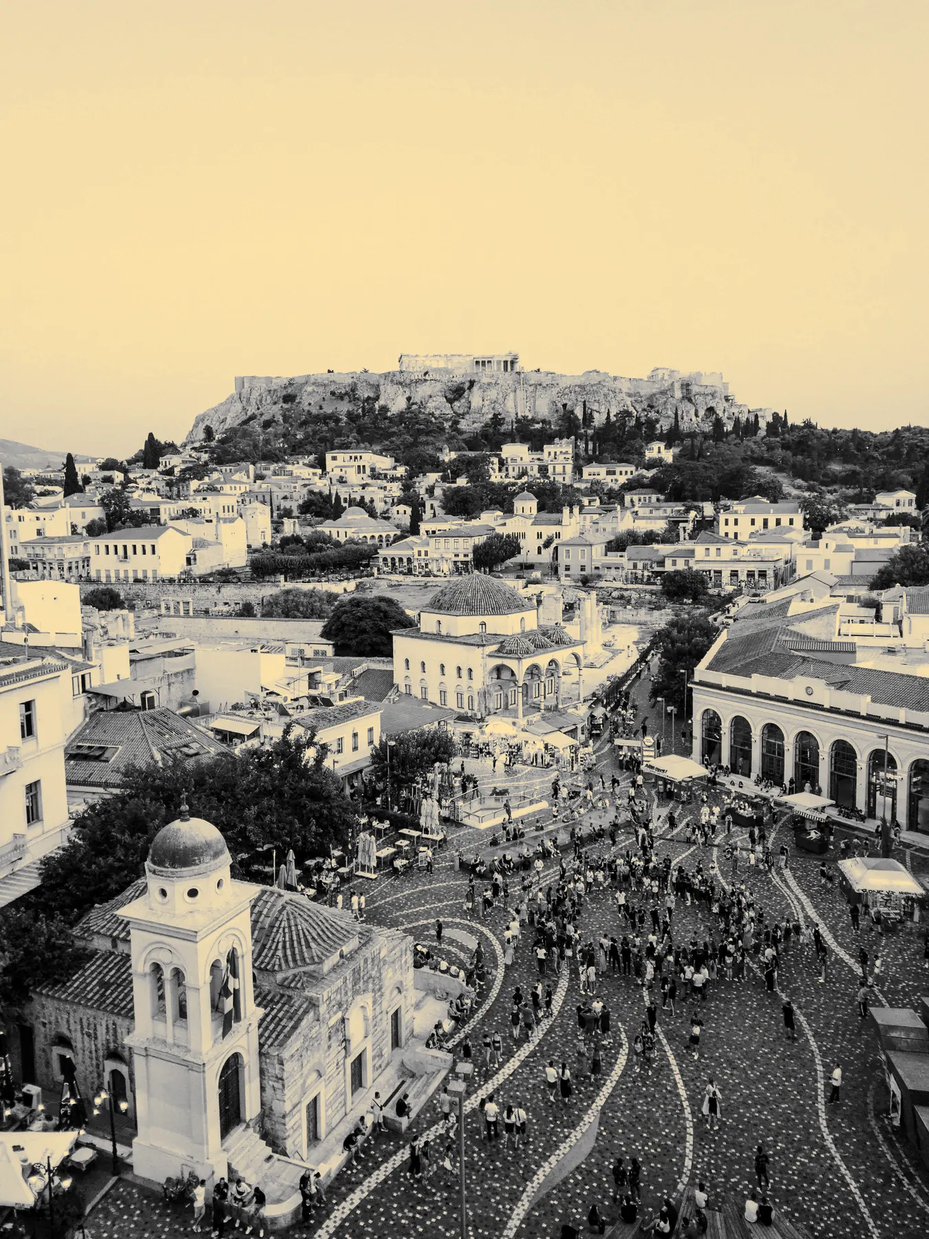
MonastirakiThe square, the flea market, and the Acropolis above it all.
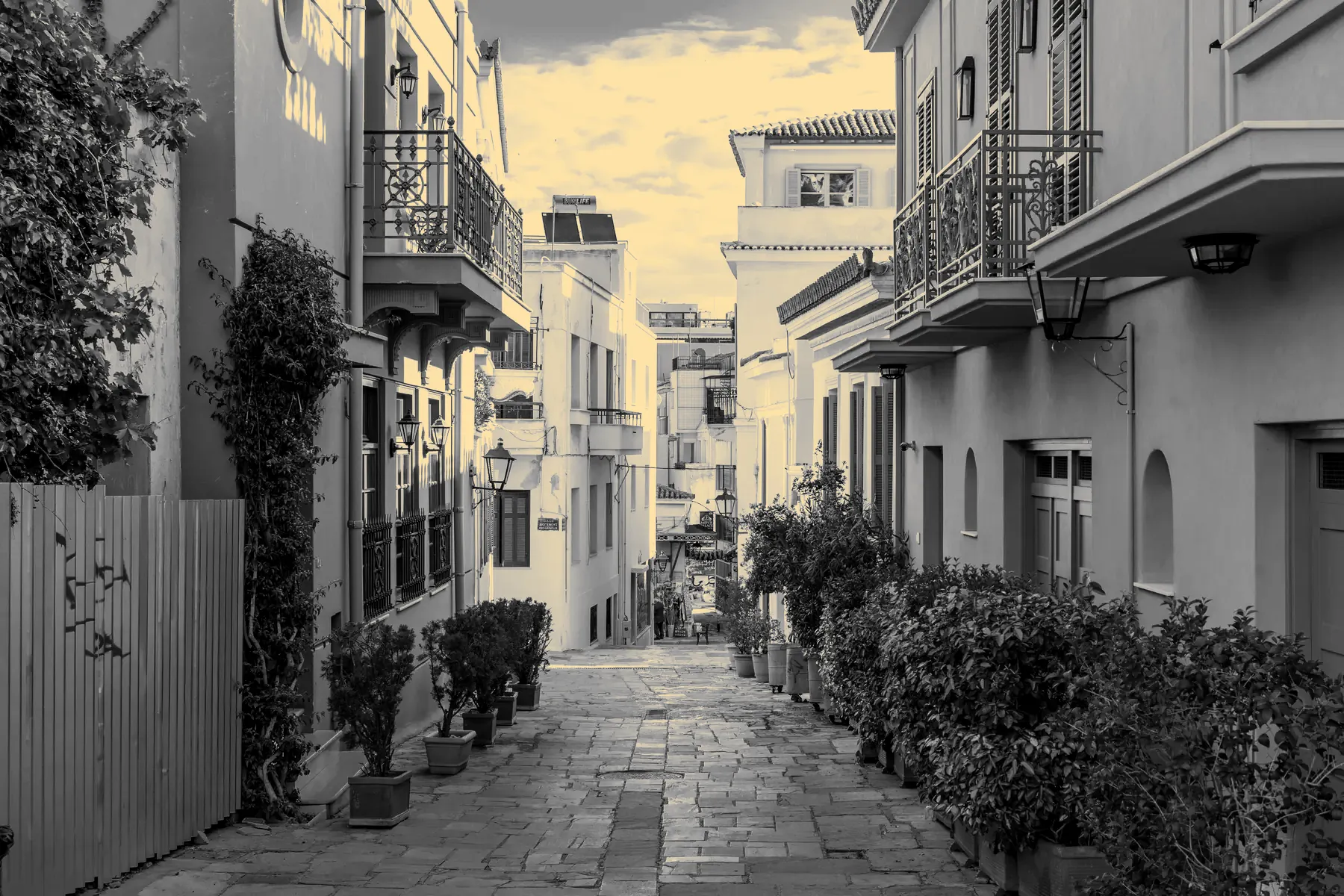
Narrow neoclassical lanes built directly on and around the ancient city — flea market, tavernas, and ruins visible through café floors.
37.9745° N · 23.7275° E
12 / 18
Plaka & Monastiraki
Plaka
Neoclassical streets in the oldest neighborhood of the city.
37.9745° N · 23.7275° E
13 / 18
Ancient & Classical · Completed 2nd century AD
Temple of Olympian Zeus
“Temple Of Olympian Zeus - Olympieion (retouched)” by Chrisfl (author as assumed by Wikimedia Commons), retouched by AlMare, via Wikimedia Commons, licensed under CC BY-SA 2.5. Cropped and colour-graded by Aktera; this adapted image is licensed under CC BY-SA 2.5.«Temple Of Olympian Zeus - Olympieion (retouched)» από Chrisfl (author as assumed by Wikimedia Commons), retouched by AlMare, μέσω Wikimedia Commons, με άδεια CC BY-SA 2.5. Περικοπή και χρωματική επεξεργασία από την Aktera· η προσαρμοσμένη εικόνα διατίθεται με άδεια CC BY-SA 2.5.“Temple Of Olympian Zeus - Olympieion (retouched)” מאת Chrisfl (author as assumed by Wikimedia Commons), retouched by AlMare, דרך Wikimedia Commons, ברישיון CC BY-SA 2.5. נחתך ועבר עיבוד צבע על ידי Aktera; התמונה המעובדת מוצעת ברישיון CC BY-SA 2.5.
Fifteen towering columns are all that remain of what was once the largest temple in Greece, standing beside Hadrian's Arch at the edge of the National Garden.
Ancient & Classical · 4th century BC, rebuilt 1896
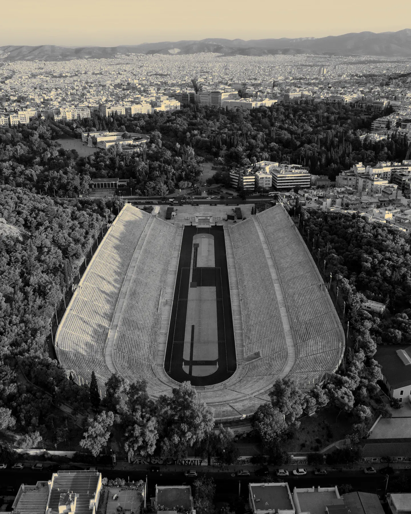
Panathenaic Stadium (Kallimarmaro)
Panathenaic StadiumThe all-marble stadium of the first modern Olympic Games.
The only stadium in the world built entirely of marble — host to the first modern Olympics in 1896, still used for the final leg of the Athens Marathon today.
“View of Lycabettus Hill from the Areopagus, Athens, 20240531 1216 9596” by Jakub Hałun, via Wikimedia Commons, licensed under CC BY 4.0. Cropped and colour-graded by Aktera; this adapted image is licensed under CC BY 4.0.«View of Lycabettus Hill from the Areopagus, Athens, 20240531 1216 9596» από Jakub Hałun, μέσω Wikimedia Commons, με άδεια CC BY 4.0. Περικοπή και χρωματική επεξεργασία από την Aktera· η προσαρμοσμένη εικόνα διατίθεται με άδεια CC BY 4.0.“View of Lycabettus Hill from the Areopagus, Athens, 20240531 1216 9596” מאת Jakub Hałun, דרך Wikimedia Commons, ברישיון CC BY 4.0. נחתך ועבר עיבוד צבע על ידי Aktera; התמונה המעובדת מוצעת ברישיון CC BY 4.0.
Athens' highest point — a funicular ride or a steep walk up to a tiny white chapel and a 360° view over every neighborhood in this guide.
“Πρόσοψη αρχαιολογικού μουσείου Αθηνών 8616” by C messier, via Wikimedia Commons, licensed under CC BY-SA 4.0. Cropped and colour-graded by Aktera; this adapted image is licensed under CC BY-SA 4.0.«Πρόσοψη αρχαιολογικού μουσείου Αθηνών 8616» από C messier, μέσω Wikimedia Commons, με άδεια CC BY-SA 4.0. Περικοπή και χρωματική επεξεργασία από την Aktera· η προσαρμοσμένη εικόνα διατίθεται με άδεια CC BY-SA 4.0.“Πρόσοψη αρχαιολογικού μουσείου Αθηνών 8616” מאת C messier, דרך Wikimedia Commons, ברישיון CC BY-SA 4.0. נחתך ועבר עיבוד צבע על ידי Aktera; התמונה המעובדת מוצעת ברישיון CC BY-SA 4.0.
Greece's largest museum — the Mask of Agamemnon and the Antikythera Mechanism sit among the richest collection of ancient Greek art anywhere in the world.
“Μονή Καισαριανής 3342” by C messier, via Wikimedia Commons, licensed under CC BY-SA 4.0. Cropped and colour-graded by Aktera; this adapted image is licensed under CC BY-SA 4.0.«Μονή Καισαριανής 3342» από C messier, μέσω Wikimedia Commons, με άδεια CC BY-SA 4.0. Περικοπή και χρωματική επεξεργασία από την Aktera· η προσαρμοσμένη εικόνα διατίθεται με άδεια CC BY-SA 4.0.“Μονή Καισαριανής 3342” מאת C messier, דרך Wikimedia Commons, ברישיון CC BY-SA 4.0. נחתך ועבר עיבוד צבע על ידי Aktera; התמונה המעובדת מוצעת ברישיון CC BY-SA 4.0.
An 11th-century monastery tucked into a spring-fed ravine on Mount Hymettus — frescoed chapel, ancient olive grove, and near-total silence twenty minutes from downtown.
Byzantine · 11th century, UNESCO World Heritage Site
Daphni Monastery
“Μονή Δαφνίου Χαϊδάρι” by Christinelle, via Wikimedia Commons, licensed under CC BY-SA 4.0. Cropped and colour-graded by Aktera; this adapted image is licensed under CC BY-SA 4.0.«Μονή Δαφνίου Χαϊδάρι» από Christinelle, μέσω Wikimedia Commons, με άδεια CC BY-SA 4.0. Περικοπή και χρωματική επεξεργασία από την Aktera· η προσαρμοσμένη εικόνα διατίθεται με άδεια CC BY-SA 4.0.“Μονή Δαφνίου Χαϊδάρι” מאת Christinelle, דרך Wikimedia Commons, ברישיון CC BY-SA 4.0. נחתך ועבר עיבוד צבע על ידי Aktera; התמונה המעובדת מוצעת ברישיון CC BY-SA 4.0.
One of the finest surviving examples of Byzantine mosaic art anywhere — a UNESCO-listed monastery on the ancient sacred road to Eleusis.
38.0130° N · 23.6359° E
Beyond Athens
Worth the trip, not worth losing the city on the map for — these sit outside Attica's dense core, each an easy day out.
km from the Acropolis, in a straight line
144
“Greece Cape Sounion BW 2017-10-09 10-06-31” by Berthold Werner, via Wikimedia Commons, licensed under CC BY-SA 3.0. Cropped and colour-graded by Aktera; this adapted image is licensed under CC BY-SA 3.0.«Greece Cape Sounion BW 2017-10-09 10-06-31» από Berthold Werner, μέσω Wikimedia Commons, με άδεια CC BY-SA 3.0. Περικοπή και χρωματική επεξεργασία από την Aktera· η προσαρμοσμένη εικόνα διατίθεται με άδεια CC BY-SA 3.0.“Greece Cape Sounion BW 2017-10-09 10-06-31” מאת Berthold Werner, דרך Wikimedia Commons, ברישיון CC BY-SA 3.0. נחתך ועבר עיבוד צבע על ידי Aktera; התמונה המעובדת מוצעת ברישיון CC BY-SA 3.0.
Cape Sounion — Temple of Poseidon
5th century BC
Marble columns on a cliff above the Aegean, an hour south of the city — Byron carved his name into one of them; the sunset here is the reason people make the drive.
227
“The tumulus (tomb) of the Athenians at Marathon” by George E. Koronaios, via Wikimedia Commons, licensed under CC0. Cropped and colour-graded by Aktera; this adapted image is licensed under CC0.«The tumulus (tomb) of the Athenians at Marathon» από George E. Koronaios, μέσω Wikimedia Commons, με άδεια CC0. Περικοπή και χρωματική επεξεργασία από την Aktera· η προσαρμοσμένη εικόνα διατίθεται με άδεια CC0.“The tumulus (tomb) of the Athenians at Marathon” מאת George E. Koronaios, דרך Wikimedia Commons, ברישיון CC0. נחתך ועבר עיבוד צבע על ידי Aktera; התמונה המעובדת מוצעת ברישיון CC0.
Marathon Tomb (Tymvos Marathona)
490 BC
The burial mound of the 192 Athenians who fell at the Battle of Marathon — the run that gave the modern marathon its name started, in legend, right here.
318
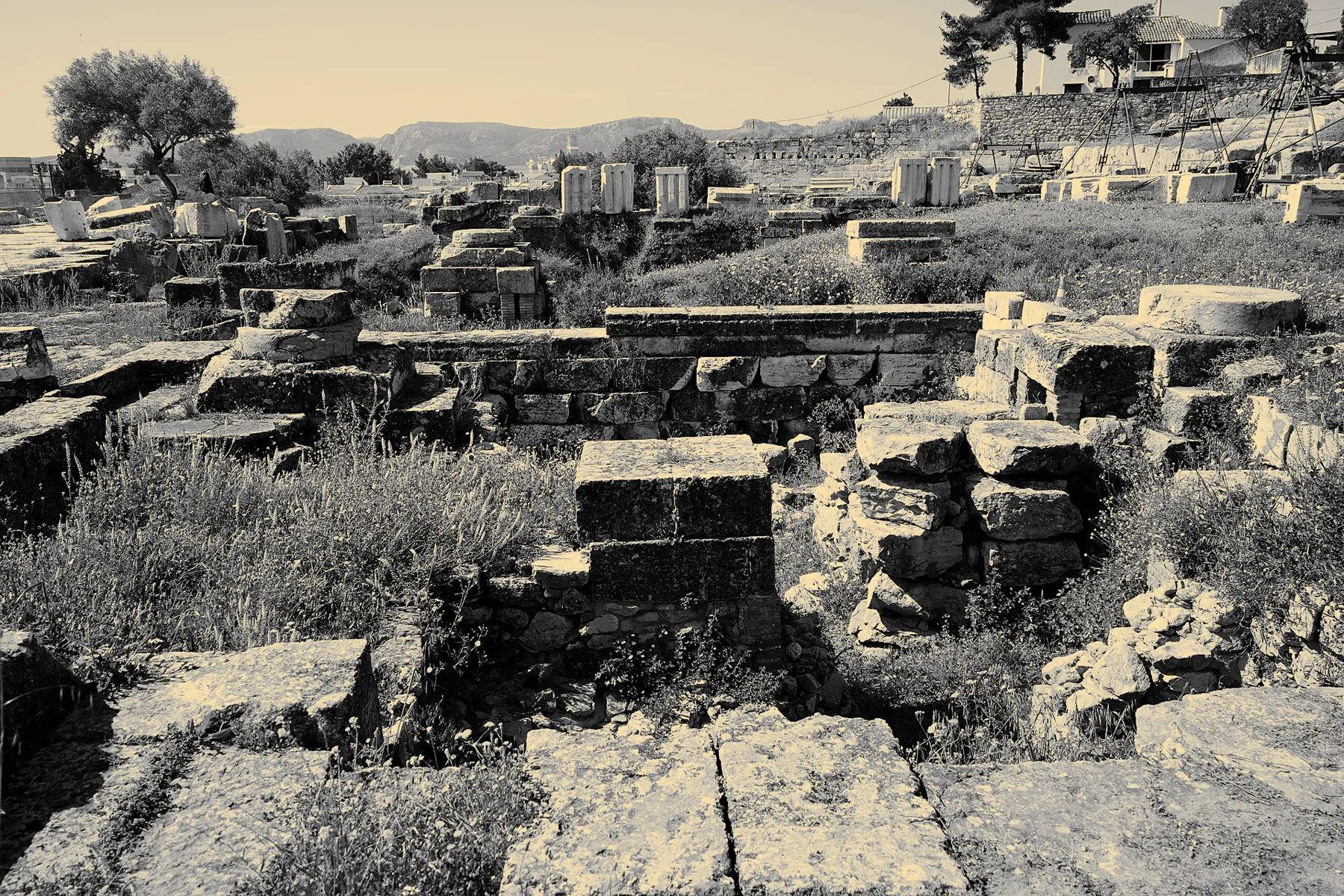
“Archaeological Site of Eleusis - Telesterion 03” by TimeTravelRome, via Wikimedia Commons, licensed under CC BY 2.0. Cropped and colour-graded by Aktera; this adapted image is licensed under CC BY 2.0.«Archaeological Site of Eleusis - Telesterion 03» από TimeTravelRome, μέσω Wikimedia Commons, με άδεια CC BY 2.0. Περικοπή και χρωματική επεξεργασία από την Aktera· η προσαρμοσμένη εικόνα διατίθεται με άδεια CC BY 2.0.“Archaeological Site of Eleusis - Telesterion 03” מאת TimeTravelRome, דרך Wikimedia Commons, ברישיון CC BY 2.0. נחתך ועבר עיבוד צבע על ידי Aktera; התמונה המעובדת מוצעת ברישיון CC BY 2.0.
Ancient Eleusis
1600 BC – 4th century AD
For nearly two thousand years, the most secret and sacred rites in the ancient world were performed here — the Eleusinian Mysteries, now an evocative ruin west of the city.
430
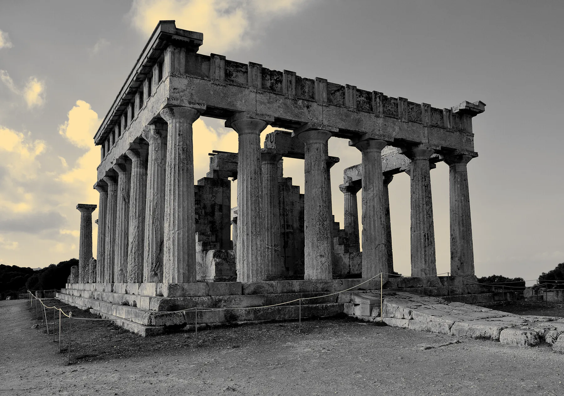
“Aegina - Temple of Aphaia 03” by Paweł 'pbm' Szubert, via Wikimedia Commons, licensed under CC BY-SA 3.0. Cropped and colour-graded by Aktera; this adapted image is licensed under CC BY-SA 3.0.«Aegina - Temple of Aphaia 03» από Paweł 'pbm' Szubert, μέσω Wikimedia Commons, με άδεια CC BY-SA 3.0. Περικοπή και χρωματική επεξεργασία από την Aktera· η προσαρμοσμένη εικόνα διατίθεται με άδεια CC BY-SA 3.0.“Aegina - Temple of Aphaia 03” מאת Paweł 'pbm' Szubert, דרך Wikimedia Commons, ברישיון CC BY-SA 3.0. נחתך ועבר עיבוד צבע על ידי Aktera; התמונה המעובדת מוצעת ברישיון CC BY-SA 3.0.
Aegina — Temple of Aphaia
5th century BC
A well-preserved Doric temple on a pine-covered hilltop, on an island a one-hour ferry from Piraeus — a full ancient-Greece day trip without a rental car.
Live closer to it
Koukaki sits at the foot of the Acropolis. Kolonaki climbs Lycabettus. Every listing on Aktera comes with a neighborhood — not just an address.

 “New Acropolis Museum building in Athens, Greece” by philip.mallis, via
 “Areopagus hill Saint Paul from Acropolis Athens” by Jebulon, via
 “The archaeological site of Kerameikos on November 17, 2019” by George E. Koronaios, via
 “Πνύκα 6213” by C messier, via
 “Monument de Philopappos crop” by Eusebius, via
 “Πύργος των Ανέμων 6173” by C messier, via
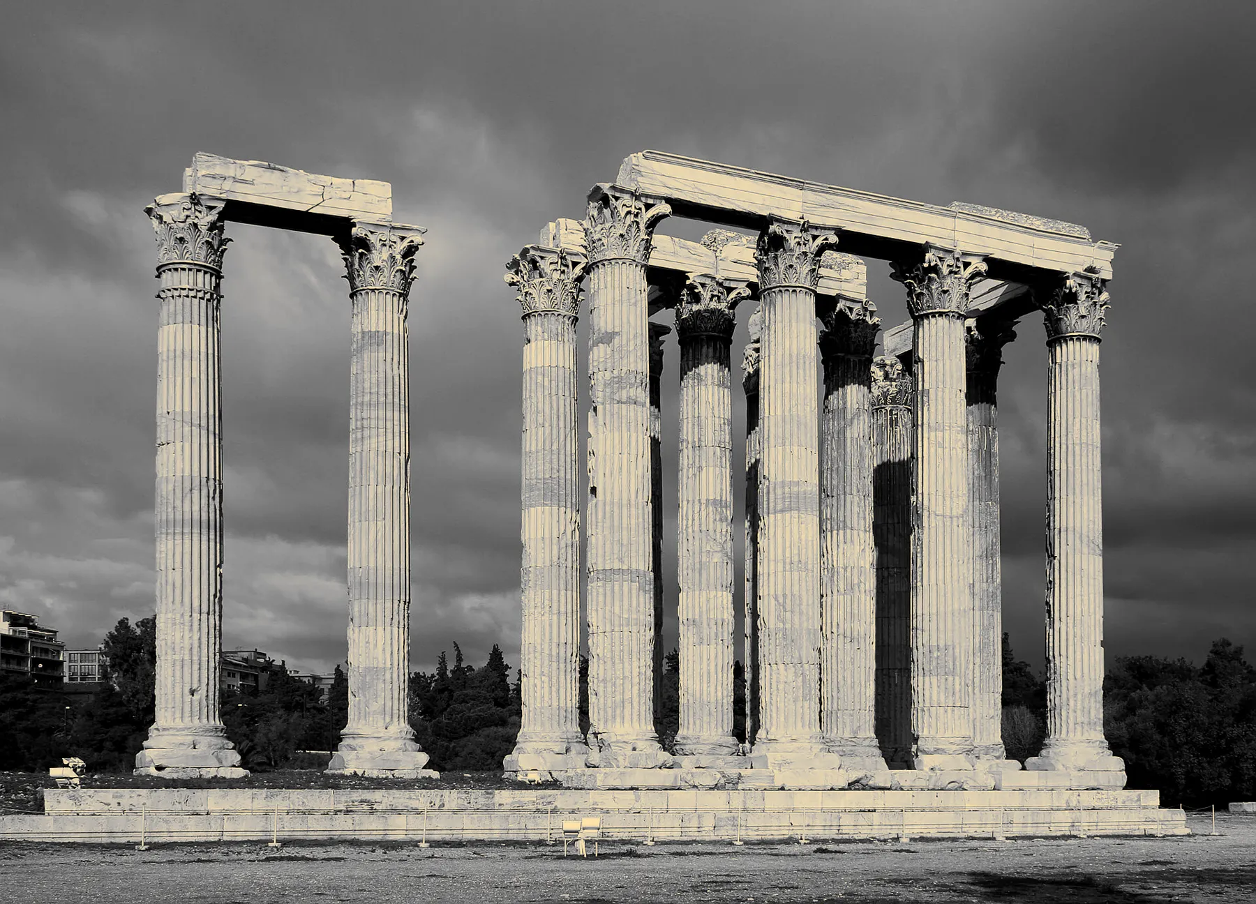 “Temple Of Olympian Zeus - Olympieion (retouched)” by Chrisfl (author as assumed by Wikimedia Commons), retouched by AlMare, via
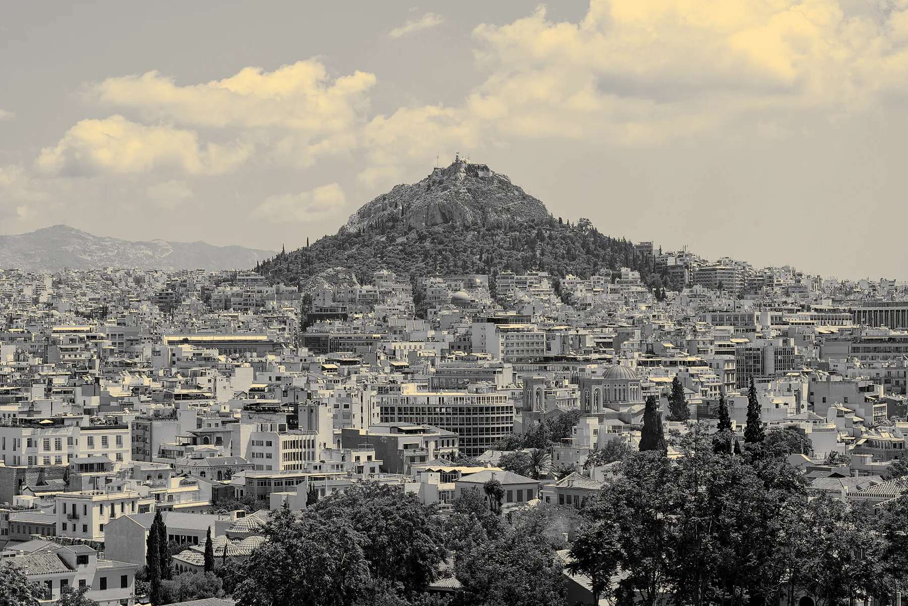 “View of Lycabettus Hill from the Areopagus, Athens, 20240531 1216 9596” by Jakub Hałun, via
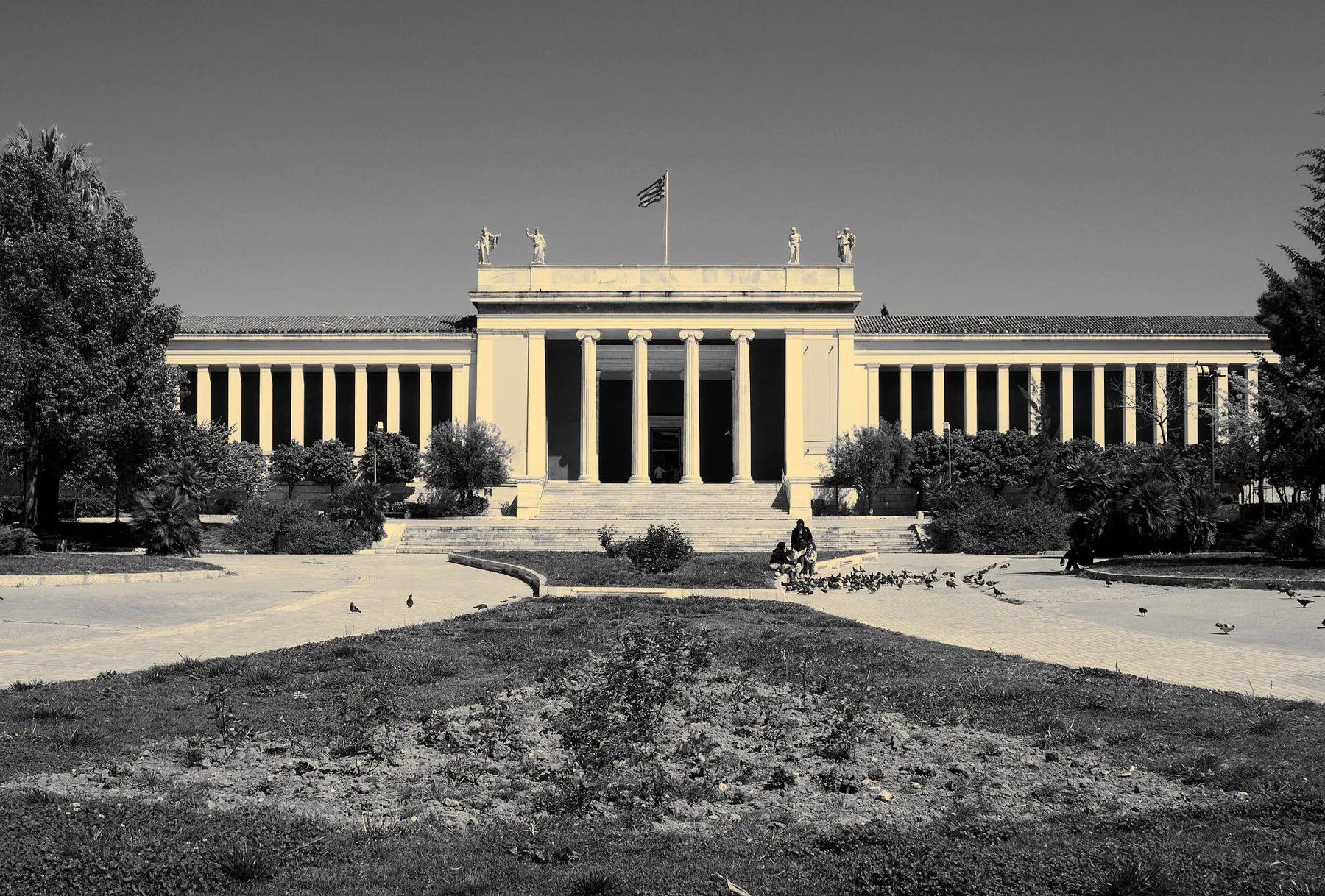 “Πρόσοψη αρχαιολογικού μουσείου Αθηνών 8616” by C messier, via
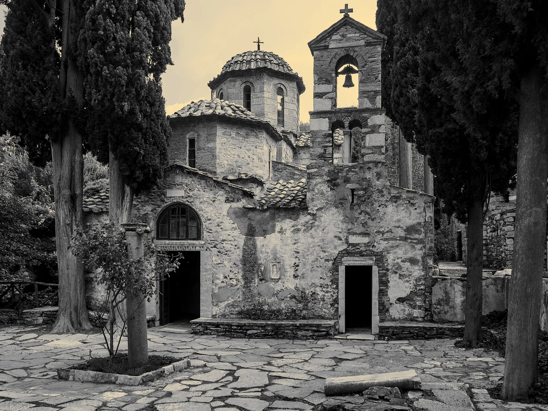 “Μονή Καισαριανής 3342” by C messier, via
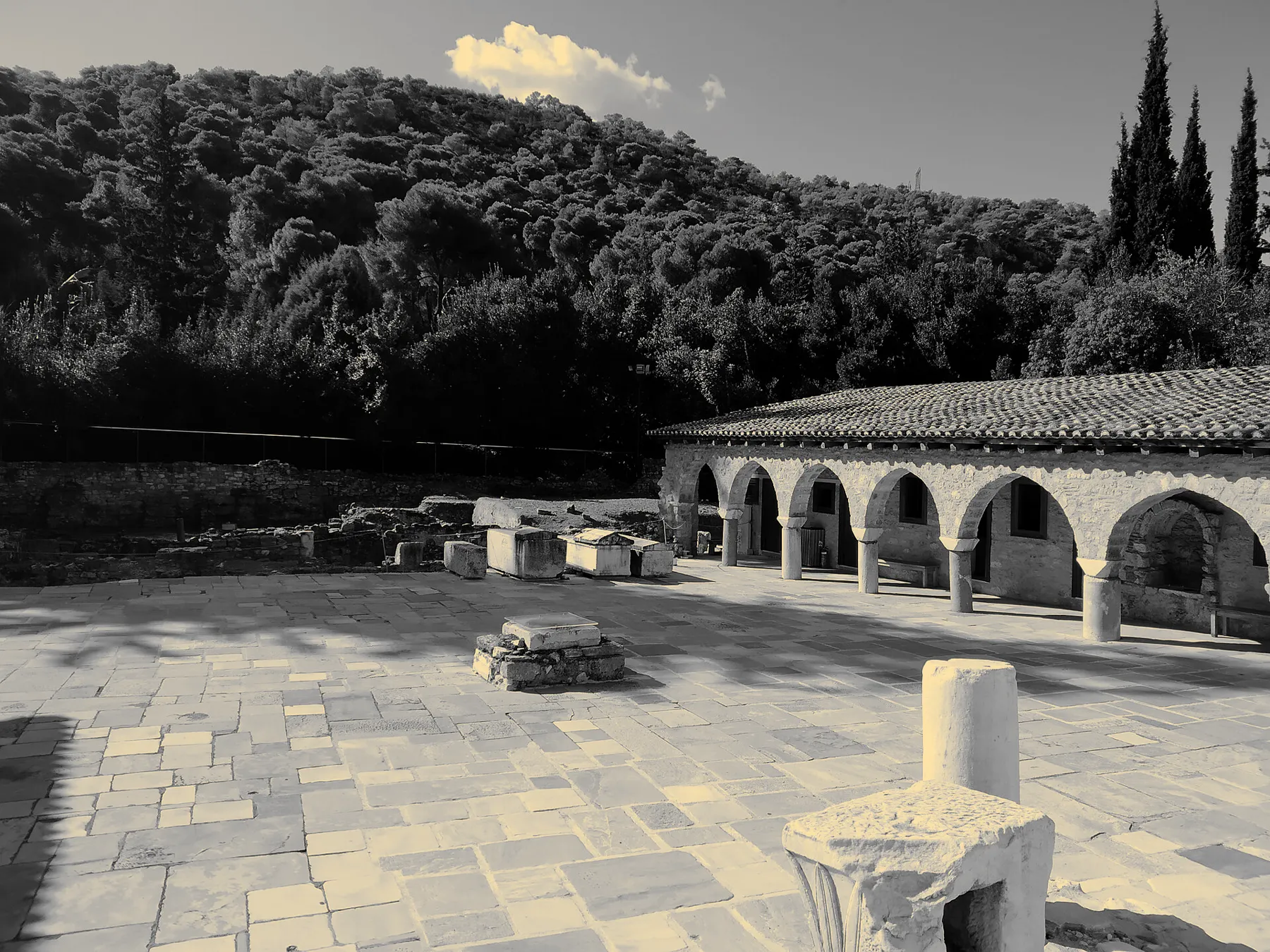 “Μονή Δαφνίου Χαϊδάρι” by Christinelle, via
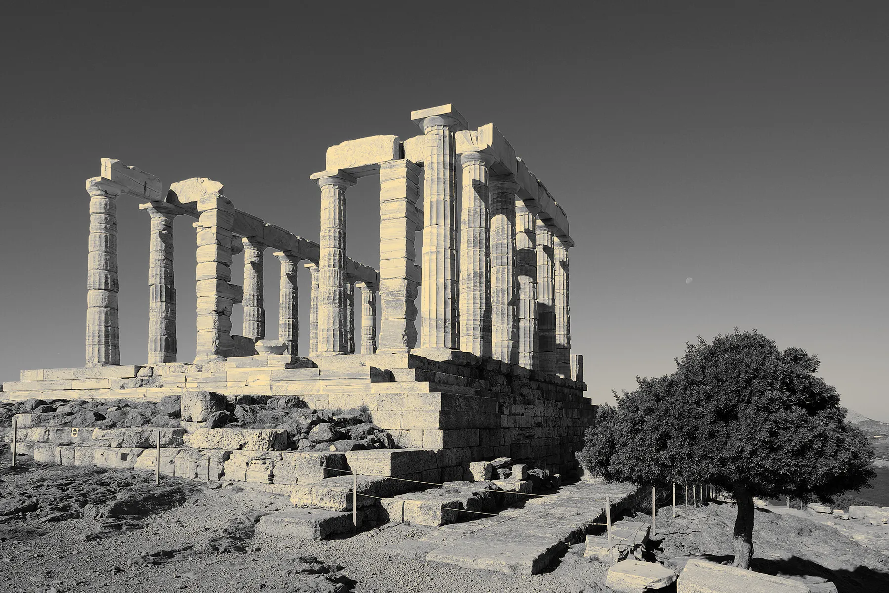 “Greece Cape Sounion BW 2017-10-09 10-06-31” by Berthold Werner, via
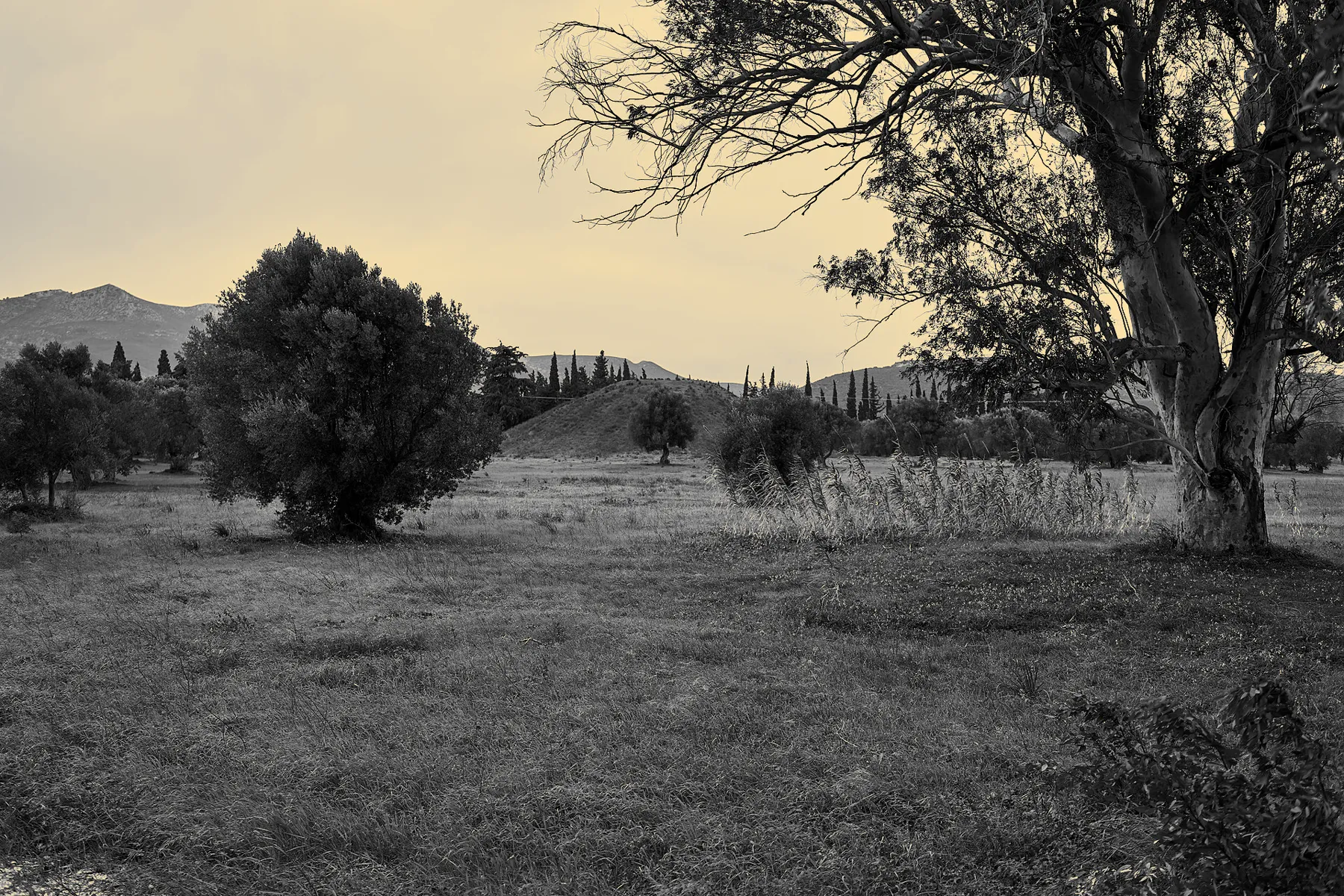 “The tumulus (tomb) of the Athenians at Marathon” by George E. Koronaios, via
 “Archaeological Site of Eleusis - Telesterion 03” by TimeTravelRome, via
 “Aegina - Temple of Aphaia 03” by Paweł 'pbm' Szubert, via